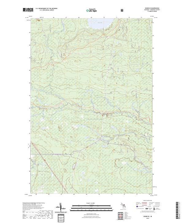
2023 Map of Ozark SE
USGS Topo · Published 2023About this map
Hiawatha National Forest dominates this landscape in Mackinac County, providing a preserved look at the Upper Peninsula’s water-rich terrain. The central waterway, the Carp Wild and Scenic River, is fed by tributaries like Taylor Creek and Spring Lake Creek as it winds through the Mackinac Wilderness. This modern survey illustrates a landscape primarily defined by its protected natural corridors rather than industrial or residential development.
Find a feature on this map
24 named features on this map. Tap any name to fly to it.
Don’t see what you’re looking for? This feature index may not catch every label — zoom into the map to look around manually.
Map Details
Editions of this 2023 Ozark SE Map
This is the sole edition of this map. No revisions or reprints were ever made.
Other maps of this area

1931 · St Ignace NW
USGS Topo · 1:31,680

1931 · Moran NE
USGS Topo · 1:31,680

1931 · Ozark SE
USGS Topo · 1:31,680

1948 · Moran NE
USGS Topo · 1:31,680

1948 · Moran NW
USGS Topo · 1:31,680

1953 · Fibre
USGS Topo · 1:24,000

1954 · Sault Sainte Marie
USGS Topo · 1:250,000

1955 · Cheboygan
USGS Topo · 1:250,000

1956 · Sault Sainte Marie
USGS Topo · 1:250,000

1957 · Sault Sainte Marie
USGS Topo · 1:250,000