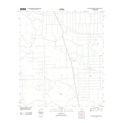
2012 Map of Packsaddle Mountain
USGS Topo · Published 2012About this map
Packsaddle Mtn anchors the high ground of this West Texas landscape in Brewster County, where the desert floor is carved by the winding drainage of Terlingua Cr. Human presence in this arid region is defined by remote outposts and essential water sources, such as Adams Ranch and the Cheosa Waterhole. The map illustrates a network of desert roads including Agua Frio Rd and Terlingua Ranch Rd that navigate the varied elevations of Gray Hill and Camels Hump. This survey reflects the modern infrastructure and private landholdings in the Chihuahuan Desert, where landmarks like Red Bluff and the Comanche Pr serve as crucial navigational points across the vast, open terrain.
Find a feature on this map
10 named features on this map. Tap any name to fly to it.
Don’t see what you’re looking for? This feature index may not catch every label — zoom into the map to look around manually.
Map Details
Editions of this 2012 Packsaddle Mountain Map
This is the sole edition of this map. No revisions or reprints were ever made.
Other maps of this area

1903 · Chisos Mountains
USGS Topo · 1:125,000

1903 · Terlingua
USGS Topo · 1:125,000

1904 · Terlingua
USGS Topo · 1:125,000

1905 · Chisos Mountains
USGS Topo · 1:125,000

1917 · Agua Fria
USGS Topo · 1:62,500

1918 · Bone Spring
USGS Topo · 1:125,000

1918 · Nine Point Mesa
USGS Topo · 1:62,500

1937 · Nine Point Mesa
USGS Topo · 1:62,500

1937 · Agua Fria
USGS Topo · 1:62,500

1959 · Emory Peak
USGS Topo · 1:250,000