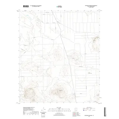
2019 Map of Packsaddle Mountain
USGS Topo · Published 2019About this map
Packsaddle Mtn and the surrounding desert floor define this section of the Trans-Pecos, where water is the primary arbiter of movement and settlement. The landscape is carved by seasonal drainages like Terlingua Cr and Nine Point Draw, leading to essential landmarks such as the Cheosa Waterhole. Significant relief is found in the scattered peaks and mesas, including Taurus Mesa, Gray Hill, and the distinctive Camels Hump. A geometric grid of roads, such as Terlingua Ranch Rd and Adonde Ave, cuts across Comanche Prairie, suggesting modern rural development and subdivision in this arid environment. These named routes, including Stargazer Rd and American Legion Rd, provide access to the remote backcountry of Brewster County.
Find a feature on this map
25 named features on this map. Tap any name to fly to it.
Don’t see what you’re looking for? This feature index may not catch every label — zoom into the map to look around manually.
Map Details
Editions of this 2019 Packsaddle Mountain Map
This is the sole edition of this map. No revisions or reprints were ever made.
Other maps of this area

1903 · Chisos Mountains
USGS Topo · 1:125,000

1903 · Terlingua
USGS Topo · 1:125,000

1904 · Terlingua
USGS Topo · 1:125,000

1905 · Chisos Mountains
USGS Topo · 1:125,000

1917 · Agua Fria
USGS Topo · 1:62,500

1918 · Bone Spring
USGS Topo · 1:125,000

1918 · Nine Point Mesa
USGS Topo · 1:62,500

1937 · Nine Point Mesa
USGS Topo · 1:62,500

1937 · Agua Fria
USGS Topo · 1:62,500

1959 · Emory Peak
USGS Topo · 1:250,000