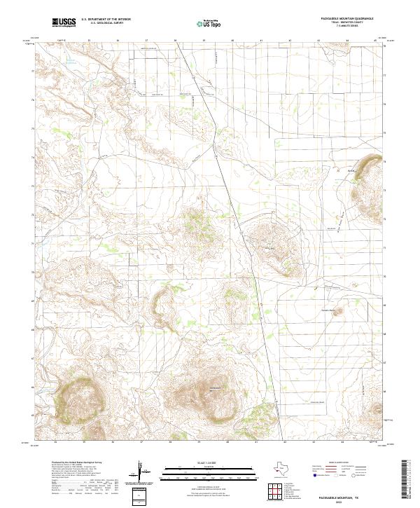
2022 Map of Packsaddle Mountain
USGS Topo · Published 2022About this map
Packsaddle Mtn and the broad flats of Comanche Prairie dominate this Brewster County landscape, revealing a remote high-desert environment defined by isolated peaks and seasonal watercourses. The map shows a network of named desert tracks and access roads, including Agua Fria Rd and Terlingua Ranch Rd, which connect scattered land holdings across the arid basin. Water remains the primary shaper of the terrain here, from the established Terlingua Creek to the critical Cheosa Waterhole in the north. Distinctive landmarks like Camels Hump and the high Taurus Mesa serve as natural beacons for navigation in a region where topography and sparse vegetation reveal the raw geology of the Trans-Pecos. This survey details the modern layout of the Terlingua Ranch area, highlighting how contemporary settlement patterns still follow the ancient paths dictated by the desert's limited water and prominent ridgelines.
Find a feature on this map
24 named features on this map. Tap any name to fly to it.
Don’t see what you’re looking for? This feature index may not catch every label — zoom into the map to look around manually.
Map Details
Editions of this 2022 Packsaddle Mountain Map
This is the sole edition of this map. No revisions or reprints were ever made.
Other maps of this area

1903 · Chisos Mountains
USGS Topo · 1:125,000

1903 · Terlingua
USGS Topo · 1:125,000

1904 · Terlingua
USGS Topo · 1:125,000

1905 · Chisos Mountains
USGS Topo · 1:125,000

1917 · Agua Fria
USGS Topo · 1:62,500

1918 · Bone Spring
USGS Topo · 1:125,000

1918 · Nine Point Mesa
USGS Topo · 1:62,500

1937 · Nine Point Mesa
USGS Topo · 1:62,500

1937 · Agua Fria
USGS Topo · 1:62,500

1959 · Emory Peak
USGS Topo · 1:250,000