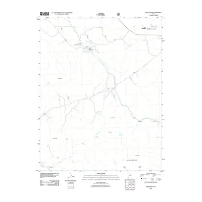
2011 Map of Page Ranch
USGS Topo · Published 2011About this map
Old Irontown and its surrounding iron mining landscape define this corner of Iron County. The map details the industrial footprint of the Columbia Steel Mine and the massive Blowout Pit at the base of Iron Mountain, illustrating the deep connection between the region's mineral wealth and its settled history. Beyond the industrial sites, the land is marked by high-country ranching operations and water management, including Lamb Reservoir held by the Stewart Lamb Dam.
Find a feature on this map
32 named features on this map. Tap any name to fly to it.
Don’t see what you’re looking for? This feature index may not catch every label — zoom into the map to look around manually.
Map Details
Editions of this 2011 Page Ranch Map
This is the sole edition of this map. No revisions or reprints were ever made.
Other maps of this area

1885 · St. George
USGS Topo · 1:250,000

1891 · St. George
USGS Topo · 1:250,000

1950 · Iron Mountain
USGS Topo · 1:62,500

1950 · Stoddard Mtn
USGS Topo · 1:24,000

1950 · Silver Peak
USGS Topo · 1:24,000

1950 · Desert Mound
USGS Topo · 1:24,000

1950 · Page Ranch
USGS Topo · 1:24,000

1951 · Silver Peak
USGS Topo · 1:24,000
1951 · Desert Mound
USGS Topo · 1:24,000

1951 · Stoddard Mtn
USGS Topo · 1:24,000