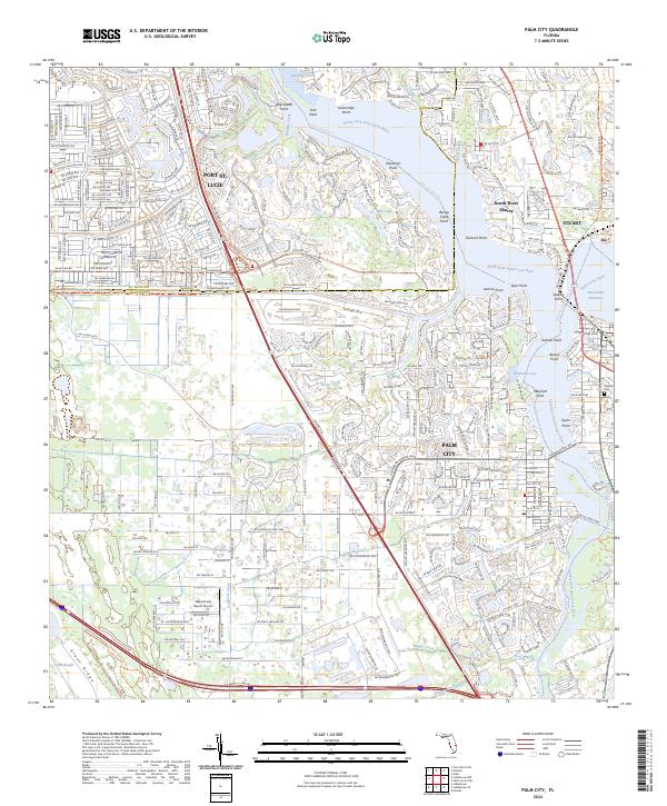
2024 Map of Palm City
USGS Topo · Published 2024About this map
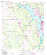
Palm City and the surrounding Treasure Coast waterways are defined by the convergence of the North Fork Saint Lucie River and South Fork Saint Lucie River. This modern landscape is a complex network of residential developments and marine infrastructure, where the Okeechobee Waterway serves as a vital navigation artery. The map captures the distinct peninsula geography of Stuart and Rio to the east, while the west is characterized by extensive drainage features like the County Line Canal and the Hanson Grant Outlet. Notable local landmarks include the Naked Lady Ranch Airport and the Florida East Coast Railway corridor, which traces the eastern bank of the river. Numerous named points along the shoreline, such as Pendarvis Point and Jenkins Point, reflect the intricate coastal topography of this established Florida maritime community.
Find a feature on this map
204 named features on this map. Tap any name to fly to it.
Don’t see what you’re looking for? This feature index may not catch every label — zoom into the map to look around manually.
Map Details
Editions of this 2024 Palm City Map
This is the sole edition of this map. No revisions or reprints were ever made.
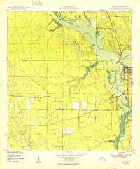
Historical Maps of Port Saint Lucie Through Time
3 maps found