
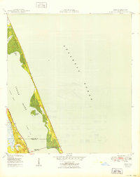
1950 Map of Palm City
USGS Topo · Published 1950About this map
The confluence of the North Fork St Lucie River and the South Fork St Lucie River anchors this 1950 coastal survey, capturing the region just before mid-century development accelerated. The settlement of Stuart is positioned along the eastern bank, connected to the mainland by the Roosevelt Bridge and served by the Florida East Coast Railway. To the west, the smaller community of Palm City sits near the mouth of Danforth Creek, surrounded by the expansive citrus groves and wetlands that define the Hanson Grant area.
Find a feature on this map
42 named features on this map. Tap any name to fly to it.
Don’t see what you’re looking for? This feature index may not catch every label — zoom into the map to look around manually.
Map Details
Editions of this 1950 Palm City Map
This is the sole edition of this map. No revisions or reprints were ever made.
Other maps of this area

1948 · Palm City
USGS Topo · 1:24,000

1948 · Ankona
USGS Topo · 1:24,000

1948 · St. Lucie Inlet
USGS Topo · 1:24,000

1948 · Gomez
USGS Topo · 1:24,000

1948 · Eden
USGS Topo · 1:24,000

1949 · Gomez
USGS Topo · 1:24,000

1950 · St. Lucie Inlet
USGS Topo · 1:24,000

1950 · Ankona
USGS Topo · 1:24,000
1950 · Eden
USGS Topo · 1:24,000

1953 · Indian Town SE
USGS Topo · 1:24,000