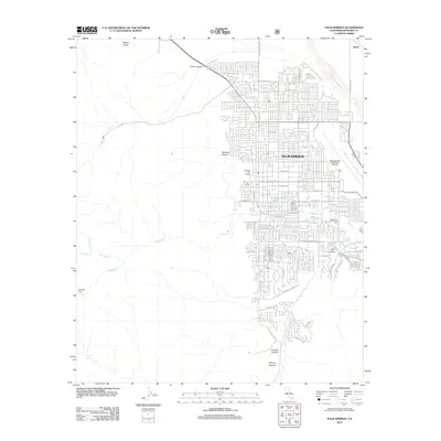
2012 Map of Palm Springs
USGS Topo · Published 2012About this map
Palm Springs serves as the focal point of this 2012 survey, illustrating the dense residential grid and recreational infrastructure that defines this desert city. The map details the developed corridor along N Indian Canyon Dr and N Gene Autry Trl, extending toward the Palm Springs Municipal Airport. Cultural and leisure sites like the O'Donald Golf Course and Fairchilds Golf Course are interspersed within the street network, while the city's eastern edge is shaped by the Palm Canyon Wash and the Baristo Flood Control Channel.
Find a feature on this map
51 named features on this map. Tap any name to fly to it.
Don’t see what you’re looking for? This feature index may not catch every label — zoom into the map to look around manually.
Map Details
Editions of this 2012 Palm Springs Map
This is the sole edition of this map. No revisions or reprints were ever made.
Other maps of this area

1901 · Southern California Sheet No. 1
USGS Topo · 1:250,000

1901 · San Jacinto
USGS Topo · 1:125,000

1904 · Indio
USGS Topo · 1:125,000

1904 · Southern California Sheet No. 1
USGS Topo · 1:250,000

1940 · Palm Springs
USGS Topo · 1:62,500

1940 · Hemet Reservoir
USGS Topo · 1:62,500

1941 · Toro Peak
USGS Topo · 1:62,500

1941 · Edom
USGS Topo · 1:62,500

1942 · Hemet Reservoir
USGS Topo · 1:62,500

1944 · Toro peak
USGS Topo · 1:62,500