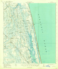
1918 Map of Palm Valley
USGS Topo · Published 1938About this map
The Florida East Coast railway corridor anchors the western half of this coastal landscape, serving as a lifeline for small stations like Durbin and Hilden. Much of the interior is dominated by extensive wetland systems, including the Cabbage Swamp and Big Island Swamp, which separate the rail line from the Atlantic coastline. The drainage patterns of Durbin Creek and the Tolomato River illustrate the difficult terrain early settlers navigated before modern drainage and development transformed the region.
Find a feature on this map
48 named features on this map. Tap any name to fly to it.
Don’t see what you’re looking for? This feature index may not catch every label — zoom into the map to look around manually.
Map Details
Editions of this 1918 Palm Valley Map
4 editions found
Other maps of this area

1917 · Orange Park
USGS Topo · 1:62,500

1918 · Jacksonville
USGS Topo · 1:62,500

1918 · Orange Park
USGS Topo · 1:62,500

1918 · Palm Valley
USGS Topo · 1:62,500

1918 · Mayport
USGS Topo · 1:62,500

1937 · Bakersville
USGS Topo · 1:24,000

1937 · St. Augustine
USGS Topo · 1:24,000

1943 · St. Augustine
USGS Topo · 1:62,500

1947 · Bostwick
USGS Topo · 1:50,000

1948 · Jacksonville
USGS Topo · 1:250,000