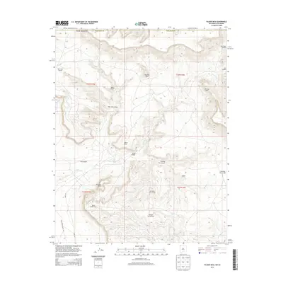
2013 Map of Palmer Mesa
USGS Topo · Published 2013About this map
Many Rocks Gallup Oil Field anchors the southern portion of this high-desert landscape in San Juan County, illustrating the industrial footprint on the land. The topography is defined by the erosion patterns of the Salt Cr Wash, which winds through several significant landforms including Palmer Mesa and the nearby Mesa Verde. Distinctive geological features with evocative names like Popping Rock, Thieving Rock, and Monument Rocks dot the terrain, suggesting a history of local navigation and landmarks.
Find a feature on this map
26 named features on this map. Tap any name to fly to it.
Don’t see what you’re looking for? This feature index may not catch every label — zoom into the map to look around manually.
Map Details
Editions of this 2013 Palmer Mesa Map
This is the sole edition of this map. No revisions or reprints were ever made.
Other maps of this area

1889 · Chaco
USGS Topo · 1:250,000

1892 · Chaco
USGS Topo · 1:250,000

1912 · Soda Canyon
USGS Topo · 1:62,500

1915 · Soda Canyon
USGS Topo · 1:62,500

1934 · Chimney Rock
USGS Topo · 1:62,500

1936 · Chimney Rock
USGS Topo · 1:62,500

1954 · Shiprock
USGS Topo · 1:250,000

1956 · Cortez
USGS Topo · 1:250,000

1958 · Cortez
USGS Topo · 1:250,000

1958 · Shiprock
USGS Topo · 1:250,000