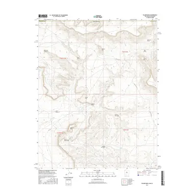
2017 Map of Palmer Mesa
USGS Topo · Published 2017About this map
Palmer Mesa and the surrounding high desert terrain dominate this 2017 survey near the border of New Mexico and Colorado. The landscape is defined by a complex network of arroyos and canyons, including Salt Cr Wash and Eagle Nest Arroyo, which drain the arid plateau. Named landmarks like Monument Rocks, Popping Rock, and Thieving Rock suggest a topography rich in distinctive geological formations that have likely served as navigational waypoints for generations.
Find a feature on this map
25 named features on this map. Tap any name to fly to it.
Don’t see what you’re looking for? This feature index may not catch every label — zoom into the map to look around manually.
Map Details
Editions of this 2017 Palmer Mesa Map
This is the sole edition of this map. No revisions or reprints were ever made.
Other maps of this area

1889 · Chaco
USGS Topo · 1:250,000

1892 · Chaco
USGS Topo · 1:250,000

1912 · Soda Canyon
USGS Topo · 1:62,500

1915 · Soda Canyon
USGS Topo · 1:62,500

1934 · Chimney Rock
USGS Topo · 1:62,500

1936 · Chimney Rock
USGS Topo · 1:62,500

1954 · Shiprock
USGS Topo · 1:250,000

1956 · Cortez
USGS Topo · 1:250,000

1958 · Cortez
USGS Topo · 1:250,000

1958 · Shiprock
USGS Topo · 1:250,000