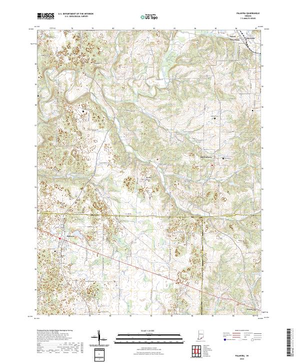
2022 Map of Palmyra
USGS Topo · Published 2022About this map
Palmyra and Martinsburg serve as central nodes in this rural landscape where the Mitchell Plain meets the drainages of the South Fork Blue River. The terrain is defined by a dense network of country roads, such as W Vincennes Trl and State Rd 135, which connect various family-named burial grounds including David Voyles Cem and Rickard Cem. The hydrology is equally prominent, with Licking Cr and Dutch Cr carving through the limestone topography, eventually feeding into bodies like Palmyra Lake and the Greenville Reservoir. Genealogists will find significant value in the distribution of several cemeteries and the well-preserved boundaries of townships and counties, including the convergence of Washington, Harrison, and Floyd counties. This map details the modern configuration of small communities like Old Pekin and New Pekin, alongside recreational spaces like the Harrison County Park Trails.
Find a feature on this map
117 named features on this map. Tap any name to fly to it.
Don’t see what you’re looking for? This feature index may not catch every label — zoom into the map to look around manually.
Map Details
Editions of this 2022 Palmyra Map
This is the sole edition of this map. No revisions or reprints were ever made.
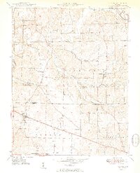
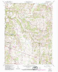
Historical Maps of Palmyra Through Time
3 maps found