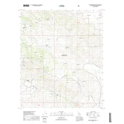
2018 Map of Palomar Observatory
USGS Topo · Published 2018About this map
The Palomar Observatory stands as a prominent landmark on the high ridges of Palomar Mt, surrounded by the protected lands of the Cleveland National Forest. This 2018 survey documents the intricate network of mountain roads and valleys north of La Jolla Amago, where the landscape is defined by the San Luis Rey River and its numerous tributaries like W Fork San Luis Rey River and Cedar Cr. The map details a series of high-elevation meadows and clearings, including Mendenhall Valley, Colb Valley, and Pedley Valley, which suggest a history of seasonal grazing and ranching. Access to these remote areas is provided by a complex system of fire roads and truck trails, such as Palomar Divide Rd and Mesa Truck Trl, connecting isolated settlements like Palomar Park to the broader San Diego County region.
Find a feature on this map
61 named features on this map. Tap any name to fly to it.
Don’t see what you’re looking for? This feature index may not catch every label — zoom into the map to look around manually.
Map Details
Editions of this 2018 Palomar Observatory Map
This is the sole edition of this map. No revisions or reprints were ever made.
Other maps of this area

1903 · Ramona
USGS Topo · 1:125,000

1904 · Southern California Sheet No. 2
USGS Topo · 1:250,000

1939 · Warner Springs
USGS Topo · 1:62,500

1939 · Santa Ysabel
USGS Topo · 1:62,500

1939 · Palomar Mountain
USGS Topo · 1:62,500

1942 · Ramona
USGS Topo · 1:62,500

1943 · Santa Ysabel
USGS Topo · 1:62,500

1943 · Warner Springs
USGS Topo · 1:62,500

1947 · Ramona
USGS Topo · 1:62,500

1947 · Santa Ana
USGS Topo · 1:250,000