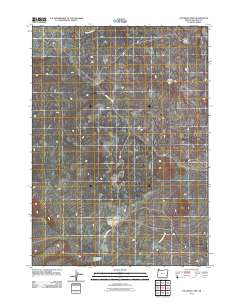
2011 Map of Palomino Lake
USGS Topo · Published 2011About this map
Iron Mountain Rd cuts across a high desert landscape dominated by volcanic geology and intermittent water sources in this Malheur County survey. The northern reaches are defined by the Saddle Butte Lava Tube and the expansive Saddle Butte Lava Field, indicating the area's complex geothermal history. These basaltic features contrast with the drainage patterns of Ryegrass Creek, which flows through the upper sections of the quadrangle.
Find a feature on this map
7 named features on this map. Tap any name to fly to it.
Don’t see what you’re looking for? This feature index may not catch every label — zoom into the map to look around manually.
Map Details
Editions of this 2011 Palomino Lake Map
This is the sole edition of this map. No revisions or reprints were ever made.
Other maps of this area

1955 · Jordan Valley
USGS Topo · 1:250,000

1955 · Burns
USGS Topo · 1:250,000

1955 · Adel
USGS Topo · 1:250,000

1955 · Boise
USGS Topo · 1:250,000

1957 · Adel
USGS Topo · 1:250,000

1957 · Jordan Valley
USGS Topo · 1:250,000

1958 · Burns
USGS Topo · 1:250,000

1958 · Boise
USGS Topo · 1:250,000

1958 · Adel
USGS Topo · 1:250,000

1958 · Jordan Valley
USGS Topo · 1:250,000