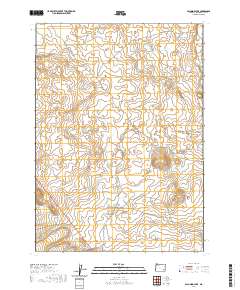
2020 Map of Palomino Lake
USGS Topo · Published 2020About this map
Saddle Butte Lava Tube and the surrounding Saddle Butte Lava Field dominate the volcanic geography of this high desert region in Malheur County. This modern survey illustrates a landscape defined by its arid hydrology, where seasonal water sources like Ryegrass Cr and Scott Butte Cr drain toward localized basins. The namesake Palomino Lake sits centrally, while human intervention in the water cycle is visible at Sheephead Reservoir in the southwest. Transport through this open range is limited to long-established primitive routes, primarily Iron Mountain Rd and Kiger Rd, which navigate the complex township and range boundaries that organize this section of the Oregon outback.
Find a feature on this map
14 named features on this map. Tap any name to fly to it.
Don’t see what you’re looking for? This feature index may not catch every label — zoom into the map to look around manually.
Map Details
Editions of this 2020 Palomino Lake Map
This is the sole edition of this map. No revisions or reprints were ever made.
Other maps of this area

1955 · Jordan Valley
USGS Topo · 1:250,000

1955 · Burns
USGS Topo · 1:250,000

1955 · Adel
USGS Topo · 1:250,000

1955 · Boise
USGS Topo · 1:250,000

1957 · Adel
USGS Topo · 1:250,000

1957 · Jordan Valley
USGS Topo · 1:250,000

1958 · Burns
USGS Topo · 1:250,000

1958 · Boise
USGS Topo · 1:250,000

1958 · Adel
USGS Topo · 1:250,000

1958 · Jordan Valley
USGS Topo · 1:250,000