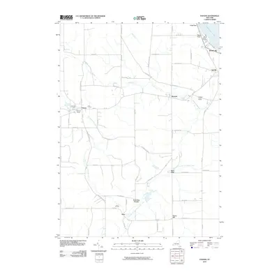
2010 Map of Panama
USGS Topo · Published 2010About this map
Little Brokenstraw Creek and its many branches define the rural character of this corner of Chautauqua County. The village of Panama sits near the western edge of the quadrangle, flanked by Greenwood Cemetery and Union Cemetery, while the distinctive geological formations of Panama Rocks lie just to the south. Further east, the landscape transitions toward the shores of Chautauqua Lake, where Ashville Bay and Niets Crest mark the waterfront.
Find a feature on this map
68 named features on this map. Tap any name to fly to it.
Don’t see what you’re looking for? This feature index may not catch every label — zoom into the map to look around manually.
Map Details
Editions of this 2010 Panama Map
This is the sole edition of this map. No revisions or reprints were ever made.
Other maps of this area

1904 · Chautaqua
USGS Topo · 1:62,500

1905 · Clymer
USGS Topo · 1:62,500

1926 · Youngsville
USGS Topo · 1:62,500

1929 · Corry
USGS Topo · 1:48,000

1929 · Youngsville
USGS Topo · 1:62,500

1932 · Corry
USGS Topo · 1:62,500

1939 · Clymer
USGS Topo · 1:62,500

1941 · Chautauqua
USGS Topo · 1:62,500

1941 · Clymer
USGS Topo · 1:62,500

1943 · Youngsville
USGS Topo · 1:62,500