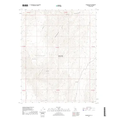
2018 Map of Panamint Butte
USGS Topo · Published 2018About this map
Panamint Butte stands as a prominent landmark within the Death Valley National Park boundaries, anchoring a landscape defined by deep drainages and high desert passes. This high-elevation terrain in the Cottonwood Mountains reveals a complex network of seasonal watercourses, including the extensive Lemoigne Canyon and its South Fork. To the south, the map tracks the descent into the Panamint Valley via the steep corridor of Panamint Canyon, while Towne Pass provides a critical transit point through the mountains. The transition from the high peaks of the Mojave Desert into narrow cuts like Dolomite Canyon illustrates the dramatic vertical relief of the Inyo County wilderness, where early travel routes were dictated by the few viable gaps in the range.
Find a feature on this map
18 named features on this map. Tap any name to fly to it.
Don’t see what you’re looking for? This feature index may not catch every label — zoom into the map to look around manually.
Map Details
Editions of this 2018 Panamint Butte Map
This is the sole edition of this map. No revisions or reprints were ever made.
Other maps of this area

1908 · Ballarat
USGS Topo · 1:250,000

1913 · Ballarat
USGS Topo · 1:250,000

1948 · Death Valley
USGS Topo · 1:250,000

1951 · Panamint Butte
USGS Topo · 1:62,500

1951 · Marble Canyon
USGS Topo · 1:62,500

1952 · Stovepipe Wells
USGS Topo · 1:62,500

1952 · Emigrant Canyon
USGS Topo · 1:62,500

1954 · Death Valley
USGS Topo · 1:250,000

1956 · Death Valley
USGS Topo · 1:250,000

1957 · Death Valley
USGS Topo · 1:250,000