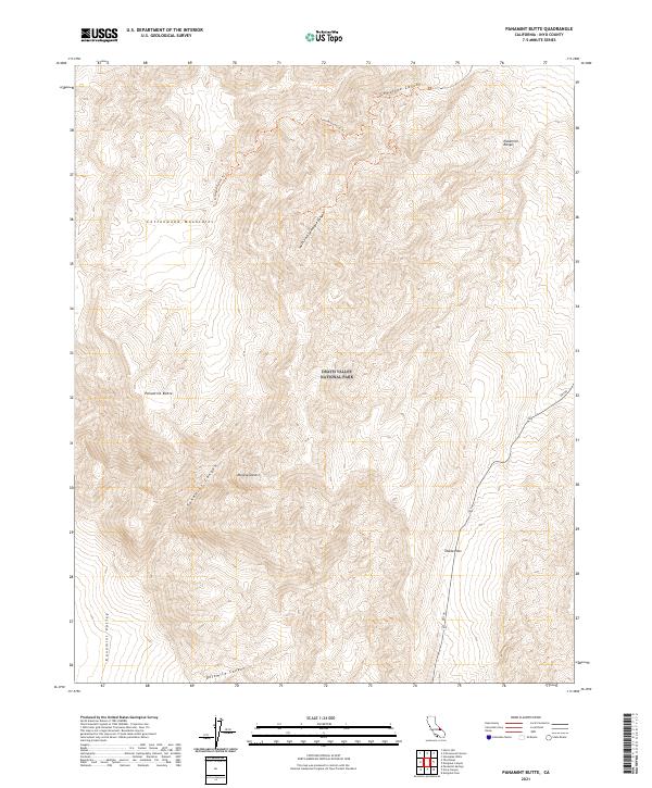
2021 Map of Panamint Butte
USGS Topo · Published 2021About this map
The Cottonwood Mountains and the northern reaches of the Panamint Range dominate this 2021 landscape within Death Valley National Park. Central to the terrain is Panamint Butte, a prominent landmark that overlooks the deep arid basins of the Mojave Desert. The map reveals a complex network of drainage systems, including Lemoigne Canyon, Panamint Canyon, and Dolomite Canyon, which illustrate the erosional patterns of this high-elevation desert environment. High-altitude travel is marked by the Lemoigne Canyon Trl, while modern transit is facilitated by Sr 190 as it crests at Towne Pass. This survey provides a precise modern record of the transition from the high peaks to the low floor of the Panamint Valley, documenting the topographic details of the California desert.
Find a feature on this map
21 named features on this map. Tap any name to fly to it.
Don’t see what you’re looking for? This feature index may not catch every label — zoom into the map to look around manually.
Map Details
Editions of this 2021 Panamint Butte Map
This is the sole edition of this map. No revisions or reprints were ever made.
Other maps of this area

1908 · Ballarat
USGS Topo · 1:250,000

1913 · Ballarat
USGS Topo · 1:250,000

1948 · Death Valley
USGS Topo · 1:250,000

1951 · Panamint Butte
USGS Topo · 1:62,500

1951 · Marble Canyon
USGS Topo · 1:62,500

1952 · Stovepipe Wells
USGS Topo · 1:62,500

1952 · Emigrant Canyon
USGS Topo · 1:62,500

1954 · Death Valley
USGS Topo · 1:250,000

1956 · Death Valley
USGS Topo · 1:250,000

1957 · Death Valley
USGS Topo · 1:250,000