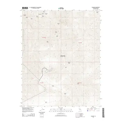
2015 Map of Panamint
USGS Topo · Published 2015About this map
Death Valley National Park encompasses much of this high-elevation landscape within the Panamint Range. The map reveals a complex network of steep drainage systems, including the aptly named Surprise Canyon, Happy Canyon, and Sourdough Canyon, which cut through the high desert. Historical activity is signaled by the presence of Arrastre Spring, a name suggesting early mining or ore-processing efforts in the region. Near Panamint Pass, the terrain reaches significant heights at Porter Peak, overlooking the Mojave Desert to the west. The distribution of remote water sources like Six Spring Canyon and Water Canyon highlights the critical importance of these features for anyone traversing Panamint or settling in Middle Park.
Find a feature on this map
26 named features on this map. Tap any name to fly to it.
Don’t see what you’re looking for? This feature index may not catch every label — zoom into the map to look around manually.
Map Details
Editions of this 2015 Panamint Map
This is the sole edition of this map. No revisions or reprints were ever made.
Other maps of this area

1908 · Furnace Creek
USGS Topo · 1:250,000

1908 · Ballarat
USGS Topo · 1:250,000

1910 · Furnace Creek
USGS Topo · 1:250,000

1913 · Ballarat
USGS Topo · 1:250,000

1915 · Searles Lake
USGS Topo · 1:250,000

1933 · Avawatz Mountains
USGS Topo · 1:250,000

1947 · Trona
USGS Topo · 1:250,000

1948 · Trona
USGS Topo · 1:250,000

1948 · Death Valley
USGS Topo · 1:250,000

1950 · Manly Peak
USGS Topo · 1:62,500