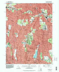
1995 Map of Park Ridge
USGS Topo · Published 1998About this map
The New York New Jersey state line bisects this 1990s-era landscape, where the suburban sprawl of Rockland County and Bergen County is defined by an intricate network of parkways and local schools. The Garden State Parkway and New York State Thruway converge near Chestnut Ridge, illustrating the mid-century transportation infrastructure that facilitated the growth of towns like Park Ridge and Pearl River. Local landmarks such as the Masonic Camp near Montebello and the Villa Marie Claire in Saddle River offer glimpses into the institutional history of the region.
Find a feature on this map
83 named features on this map. Tap any name to fly to it.
Don’t see what you’re looking for? This feature index may not catch every label — zoom into the map to look around manually.
Map Details
Editions of this 1995 Park Ridge Map
This is the sole edition of this map. No revisions or reprints were ever made.
Other maps of this area

1888 · Paterson
USGS Topo · 1:62,500

1891 · Ramapo
USGS Topo · 1:62,500

1891 · Harlem
USGS Topo · 1:62,500

1892 · Paterson
USGS Topo · 1:62,500

1892 · Tarrytown
USGS Topo · 1:62,500

1893 · Tarrytown
USGS Topo · 1:62,500

1893 · Ramapo
USGS Topo · 1:62,500

1897 · Harlem
USGS Topo · 1:62,500

1898 · Harlem
USGS Topo · 1:62,500

1898 · Paterson
USGS Topo · 1:62,500