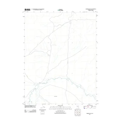
2011 Map of Parker Butte
USGS Topo · Published 2011About this map
The Walker River meanders through the southern portion of this Lyon County landscape, creating a fertile corridor for ranching operations in an otherwise arid region. Named family-held properties such as JJ Ranch and Parker Ranch are situated along the riverbanks, marking the established agricultural footprint of the area. Further south, the settlement of Lux sits near the river's edge, highlighting the historical reliance of local communities on this vital water source. The terrain is anchored by the prominent rise of Parker Butte, which dominates the local topography south of the river. Infrastructure like Powerline Rd and Julian Ln cut through the open spaces, while Black Point Spring provides a distinct hydrological point of interest in the higher ground north of the river's path.
Find a feature on this map
8 named features on this map. Tap any name to fly to it.
Don’t see what you’re looking for? This feature index may not catch every label — zoom into the map to look around manually.
Map Details
Editions of this 2011 Parker Butte Map
This is the sole edition of this map. No revisions or reprints were ever made.
Other maps of this area

1891 · Wabuska
USGS Topo · 1:125,000

1894 · Wabuska
USGS Topo · 1:125,000

1908 · Carson Sink
USGS Topo · 1:250,000

1910 · Carson Sink
USGS Topo · 1:250,000

1951 · Weber Reservoir
USGS Topo · 1:62,500

1951 · Fallon
USGS Topo · 1:62,500

1957 · Wabuska
USGS Topo · 1:62,500

1957 · Silver Springs
USGS Topo · 1:62,500

1957 · Reno
USGS Topo · 1:250,000

1959 · Reno
USGS Topo · 1:250,000