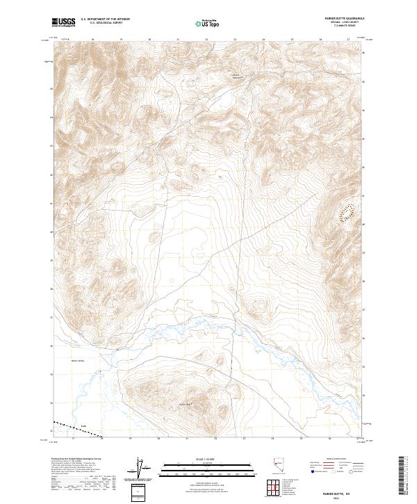
2021 Map of Parker Butte
USGS Topo · Published 2021About this map
Mason Valley serves as the central focal point of this Nevada landscape, where the Walker River meanders through the southern half of the quadrangle. The terrain transitions from the alluvial floor of the valley toward the prominent heights of Parker Butte and the northern reaches of the Desert Mountains. Evidence of local water management and agricultural history is visible through features like the Wabuska Drain and Black Point Spring, which suggest the vital importance of irrigation in this arid environment. The small settlement of Lux and the corridor along Julian Ln anchor the human geography of the area, providing a record of rural development within Lyon County during the early twenty-first century.
Find a feature on this map
13 named features on this map. Tap any name to fly to it.
Don’t see what you’re looking for? This feature index may not catch every label — zoom into the map to look around manually.
Map Details
Editions of this 2021 Parker Butte Map
This is the sole edition of this map. No revisions or reprints were ever made.
Other maps of this area

1891 · Wabuska
USGS Topo · 1:125,000

1894 · Wabuska
USGS Topo · 1:125,000

1908 · Carson Sink
USGS Topo · 1:250,000

1910 · Carson Sink
USGS Topo · 1:250,000

1951 · Weber Reservoir
USGS Topo · 1:62,500

1951 · Fallon
USGS Topo · 1:62,500

1957 · Wabuska
USGS Topo · 1:62,500

1957 · Silver Springs
USGS Topo · 1:62,500

1957 · Reno
USGS Topo · 1:250,000

1959 · Reno
USGS Topo · 1:250,000