
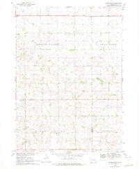
1968 Map of Parker SW
USGS Topo · Published 1971About this map
Turkey Ridge rises above the southeastern South Dakota landscape, providing a prominent topographic divide between the drainages of Hurley Creek and Turkey Ridge Creek. This 1968 field-checked survey reveals a rural landscape defined by the section-line grid of the late 1960s, where small community hubs centered around country schools and churchyards. Educational life is documented through scattered landmarks like Prairie Rock Sch and Pleasant Ridge Sch, while local genealogy is anchored by sites such as Turkey Valley Cem and Bethany Cem. The southeastern corner is marked by Swan Lake, showing the area's natural hydrology before modern intensive development. The map effectively captures the townships of Marion, Norway, and Hurley at a time when traditional rural structures remained central to the region's geography.
Find a feature on this map
15 named features on this map. Tap any name to fly to it.
Don’t see what you’re looking for? This feature index may not catch every label — zoom into the map to look around manually.
Map Details
Editions of this 1968 Parker SW Map
This is the sole edition of this map. No revisions or reprints were ever made.
Other maps of this area

1898 · Parker
USGS Topo · 1:125,000

1955 · Sioux Falls
USGS Topo · 1:250,000

1958 · Sioux Falls
USGS Topo · 1:250,000
1968 · Parker NE
USGS Topo · 1:24,000
1968 · Hurley
USGS Topo · 1:24,000
1968 · Viborg
USGS Topo · 1:24,000
1968 · Parker
USGS Topo · 1:24,000

1970 · Turkey Ridge
USGS Topo · 1:24,000

1970 · Freeman SE
USGS Topo · 1:24,000
1970 · Center Point
USGS Topo · 1:24,000
Featured Places
- Norway Township, SD
- Parker Township, SD
- Swan Lake Township, SD
- Marion Township, SD
- Spring Valley Township, SD