2022 Map of Parkersburg
USGS Topo · Published 2022About this map
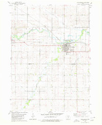
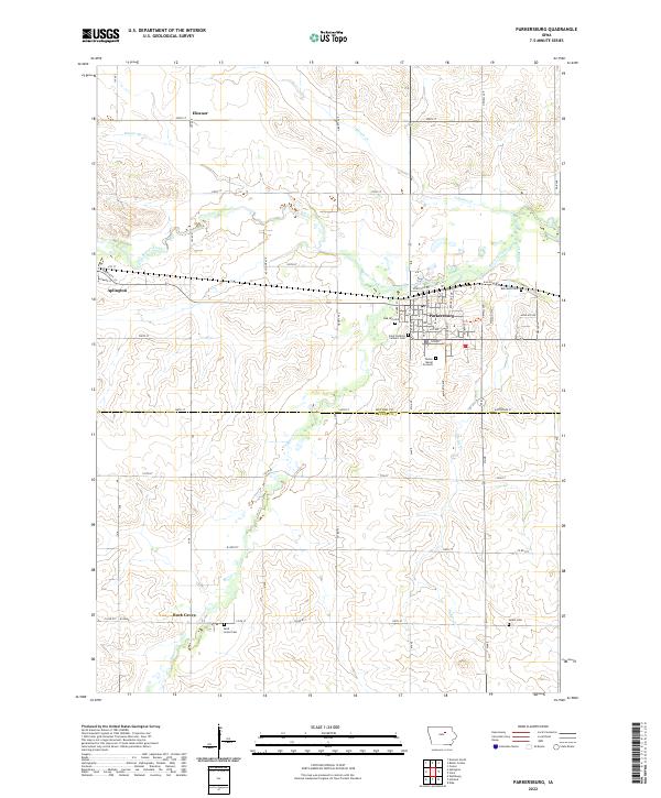
Parkersburg serves as a primary hub in this corner of Butler County, where the grid of city streets like Florence St and Brookside Dr meets the agricultural landscape. The town's historical fabric is evident in its numerous memorial sites, including the Parker Burial Grounds and Oak Hill Cem, while Saint Patricks Catholic Cem lies on the western edge. North of the town center, Beaver Creek and its tributaries such as Johnson Cr weave through the township, carving subtle valleys into the till plain.
Find a feature on this map
65 named features on this map. Tap any name to fly to it.
Don’t see what you’re looking for? This feature index may not catch every label — zoom into the map to look around manually.
Map Details
Editions of this 2022 Parkersburg Map
This is the sole edition of this map. No revisions or reprints were ever made.