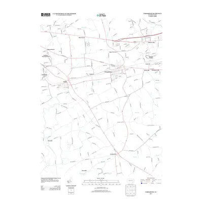
2013 Map of Parkesburg
USGS Topo · Published 2013About this map
Parkesburg and the surrounding Chester County townships are defined by a dense network of early settlements and agricultural valleys. This 2013 survey documents the enduring layout of historic Quaker-associated landmarks like the Sadsbury Meeting House and the clustering of villages such as Sadsburyville, Atglen, and Cochranville. The landscape is heavily dissected by numerous watercourses, including Valley Cr, Officers Run, and Doe Run, which historically influenced the placement of early road corridors and milling sites. Many of these communities, including Lenover and Pomeroy, maintain a distinct separation from one another, reflecting the rural character of the region. The map also traces the transition from Christiana through Steelville, showing the persistent footprint of small-town development amidst the productive farmsteads of the Pennsylvania countryside.
Find a feature on this map
199 named features on this map. Tap any name to fly to it.
Don’t see what you’re looking for? This feature index may not catch every label — zoom into the map to look around manually.
Map Details
Editions of this 2013 Parkesburg Map
This is the sole edition of this map. No revisions or reprints were ever made.
Other maps of this area

1904 · Coatesville
USGS Topo · 1:62,500

1905 · Honey Brook
USGS Topo · 1:62,500

1906 · Coatesville
USGS Topo · 1:62,500

1906 · New Holland
USGS Topo · 1:62,500

1907 · Honeybrook
USGS Topo · 1:62,500

1908 · New Holland
USGS Topo · 1:62,500

1912 · Quarryville
USGS Topo · 1:62,500

1918 · Coatesville
USGS Topo · 1:62,500

1941 · Honeybrook
USGS Topo · 1:62,500

1941 · New Holland
USGS Topo · 1:62,500