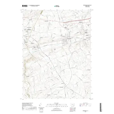
2019 Map of Parkesburg
USGS Topo · Published 2019About this map
The Sadsbury Meeting House and the surrounding township terrain highlight a landscape steeped in Quaker and Mennonite heritage at the border of Chester and Lancaster counties. This contemporary map documents the enduring footprint of historic religious sites and burial grounds, such as the Sadsbury Friends Burial Ground and the Simmontown Mennonite Church Cem. The topography is defined by the South Valley Hills and a network of waterways including Valley Cr and the West Branch Octoraro Creek. Major transportation corridors like the Octorara Trl and Gap Newport Pike connect established settlements like Parkesburg and Cochranville. The presence of the Chester County G O Carlson Airport near Pomeroy Heights reflects the modern aviation layer atop this traditional agricultural and residential corridor.
Find a feature on this map
194 named features on this map. Tap any name to fly to it.
Don’t see what you’re looking for? This feature index may not catch every label — zoom into the map to look around manually.
Map Details
Editions of this 2019 Parkesburg Map
This is the sole edition of this map. No revisions or reprints were ever made.
Other maps of this area

1904 · Coatesville
USGS Topo · 1:62,500

1905 · Honey Brook
USGS Topo · 1:62,500

1906 · Coatesville
USGS Topo · 1:62,500

1906 · New Holland
USGS Topo · 1:62,500

1907 · Honeybrook
USGS Topo · 1:62,500

1908 · New Holland
USGS Topo · 1:62,500

1912 · Quarryville
USGS Topo · 1:62,500

1918 · Coatesville
USGS Topo · 1:62,500

1941 · Honeybrook
USGS Topo · 1:62,500

1941 · New Holland
USGS Topo · 1:62,500