2023 Map of Parkesburg
USGS Topo · Published 2023About this map
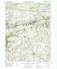
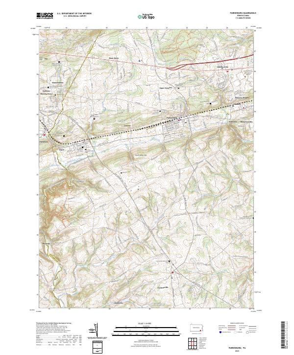
The South Valley Hills and Gap Hill define the topographical character of this section of the Piedmont, where the Lancaster Co Chester Co line cuts through a landscape of established villages and longstanding religious sites. At the heart of the sheet is Parkesburg, situated between Upper Octoraro and the smaller settlements of Lenover and Pomeroy. The area is notably dense with denominational history, from the Sadsbury Friends Burial Ground to the Mount Zion African Methodist Episcopal Cem and Simmonstown Mennonite Church Cem. The eastern portion is marked by the Chester County G O Carlson Airport near Sadsburyville, while the southern reaches descend toward Cochranville near the headwaters of Knight Run and Doe Run. This modern map traces how 21st-century infrastructure, like the Enola Low Grade Trl, follows the path of older transport corridors through the undulating terrain.
Find a feature on this map
173 named features on this map. Tap any name to fly to it.
Don’t see what you’re looking for? This feature index may not catch every label — zoom into the map to look around manually.
Map Details
Editions of this 2023 Parkesburg Map
This is the sole edition of this map. No revisions or reprints were ever made.