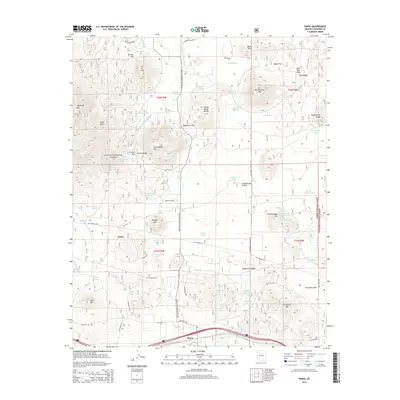
2014 Map of Parks
USGS Topo · Published 2014About this map
The high plateau landscape of northern Arizona unfolds in this 2014 survey, where the small community of Parks sits at the intersection of historical transportation corridors. The terrain is a mix of volcanic peaks and open meadows, dominated by the massive Sitgreaves Mtn and the broad expanse of Government Prairie. This area reveals layers of Western history, from the early Beale Wagon Rd to the legendary Old Rte 66. Water, always a critical resource in this arid forest environment, is meticulously mapped through numerous livestock tanks and natural features like Beale Spring and Sawmill Spring. The map covers portions of both the Kaibab National Forest and Coconino National Forest, illustrating how forestry and grazing shaped the local infrastructure, including the many Subdivision Rds and specialized routes like the Spring Vly Garland Pr Loop.
Find a feature on this map
77 named features on this map. Tap any name to fly to it.
Don’t see what you’re looking for? This feature index may not catch every label — zoom into the map to look around manually.
Map Details
Editions of this 2014 Parks Map
This is the sole edition of this map. No revisions or reprints were ever made.
Other maps of this area

1886 · San Francisco Mtns
USGS Topo · 1:250,000

1886 · Chino
USGS Topo · 1:250,000

1891 · San Francisco Mtns
USGS Topo · 1:250,000

1891 · Chino
USGS Topo · 1:250,000

1894 · San Francisco Mtns
USGS Topo · 1:250,000

1899 · San Francisco Mtns
USGS Topo · 1:250,000

1908 · Flagstaff
USGS Topo · 1:125,000

1912 · Flagstaff
USGS Topo · 1:125,000

1922 · Williams
USGS Topo · 1:125,000

1947 · Flagstaff
USGS Topo · 1:250,000