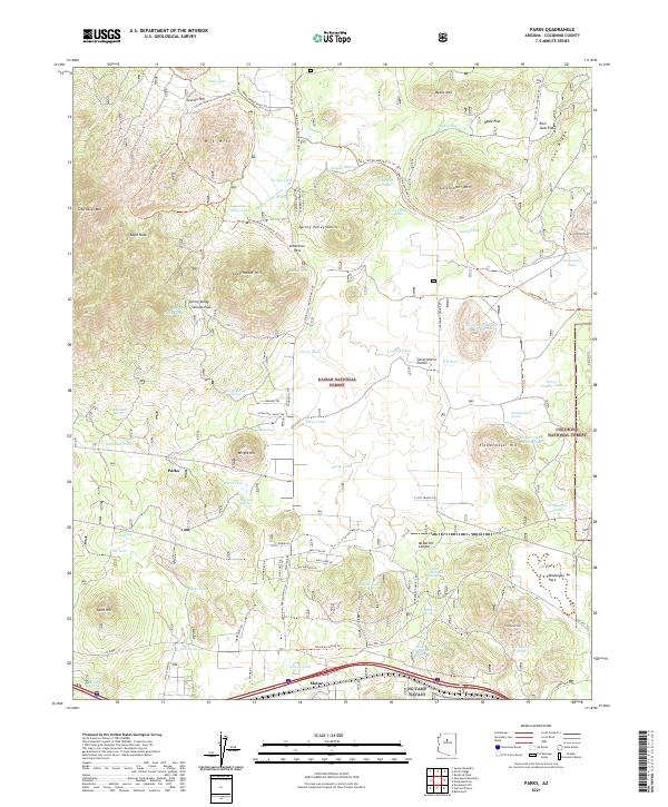
2021 Map of Parks
USGS Topo · Published 2021About this map
The high plateau of northern Arizona's mountain country is captured here, centered on the community of Parks and the small settlement of Maine. The landscape is dominated by volcanic peaks and high-altitude features like Government Mtn and Sitgreaves Mtn, while the southern portion of the map traces the enduring legacy of western travel. The corridor of the famous Old Rte. "66" parallels the modern interstate, while the Route 66 Hiking Trl offers a pedestrian connection to this storied highway. North of the mountain summits, the historic Beale Wagon Road Trl crosses Beale Flat, following a path established in the mid-19th century. This area, split between the Kaibab National Forest and Coconino National Forest, shows a complex network of seasonal water sources such as Sego Tank and Government Hole, essential for ranching and forest management in this arid but forested terrain.
Find a feature on this map
80 named features on this map. Tap any name to fly to it.
Don’t see what you’re looking for? This feature index may not catch every label — zoom into the map to look around manually.
Map Details
Editions of this 2021 Parks Map
This is the sole edition of this map. No revisions or reprints were ever made.
Other maps of this area

1886 · San Francisco Mtns
USGS Topo · 1:250,000

1886 · Chino
USGS Topo · 1:250,000

1891 · San Francisco Mtns
USGS Topo · 1:250,000

1891 · Chino
USGS Topo · 1:250,000

1894 · San Francisco Mtns
USGS Topo · 1:250,000

1899 · San Francisco Mtns
USGS Topo · 1:250,000

1908 · Flagstaff
USGS Topo · 1:125,000

1912 · Flagstaff
USGS Topo · 1:125,000

1922 · Williams
USGS Topo · 1:125,000

1947 · Flagstaff
USGS Topo · 1:250,000