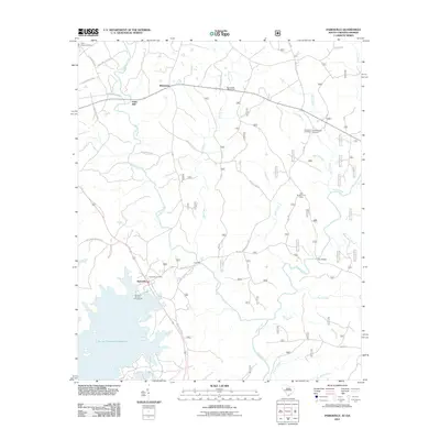
2011 Map of Parksville
USGS Topo · Published 2011About this map
J. Strom Thurmond Reservoir defines the southwestern landscape of this region, providing a modern shoreline for the Hamilton Branch Campground. The settlement of Parksville stands at the edge of this transition, where the reservoir meets the complex drainage system of Stevens Creek and Turkey Creek. This 2011 survey documents a rural environment shaped by several small communities and historical family-named landmarks including Whitetown, Parks Mill, and Prices Mill. Genealogists may find value in the various burial grounds identified, such as New Hope Cemetery and the adjacent Rohoboth Cemetery and Old Rohoboth Cemetery. The network of backroads, including Prices Mill Rd and Key Rd, links these dispersed settlements with recreational sites like the Key Bridge Hunt Camp and the Byrd Creek Rifle Range.
Find a feature on this map
43 named features on this map. Tap any name to fly to it.
Don’t see what you’re looking for? This feature index may not catch every label — zoom into the map to look around manually.
Map Details
Editions of this 2011 Parksville Map
This is the sole edition of this map. No revisions or reprints were ever made.
Other maps of this area

1892 · Mc Cormick
USGS Topo · 1:125,000

1912 · Mc Cormick
USGS Topo · 1:125,000

1920 · Clarks Hill
USGS Topo · 1:48,000

1921 · Clarks Hill
USGS Topo · 1:62,500

1921 · Appling
USGS Topo · 1:62,500

1941 · Clarks Hill
USGS Topo · 1:62,500

1942 · Clarks Hill
USGS Topo · 1:62,500

1943 · Appling
USGS Topo · 1:62,500

1953 · Athens
USGS Topo · 1:250,000

1958 · Athens
USGS Topo · 1:250,000