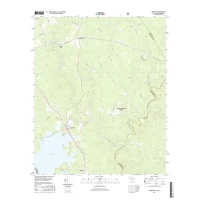
2017 Map of Parksville
USGS Topo · Published 2017About this map
The J. Strom Thurmond Reservoir defines the western edge of this McCormick County landscape, where the waters meet the wooded expanse of the Sumter National Forest. The settlement of Parksville serves as a local hub, anchored by the Parksville Cem and connected to the rural interior via Prices Mill Rd and Mt Lebanon Church Rd. To the north, Parks Mill and Whitetown represent established community nodes along the route to the Edgefield County line.
Find a feature on this map
62 named features on this map. Tap any name to fly to it.
Don’t see what you’re looking for? This feature index may not catch every label — zoom into the map to look around manually.
Map Details
Editions of this 2017 Parksville Map
This is the sole edition of this map. No revisions or reprints were ever made.
Other maps of this area

1892 · Mc Cormick
USGS Topo · 1:125,000

1912 · Mc Cormick
USGS Topo · 1:125,000

1920 · Clarks Hill
USGS Topo · 1:48,000

1921 · Clarks Hill
USGS Topo · 1:62,500

1921 · Appling
USGS Topo · 1:62,500

1941 · Clarks Hill
USGS Topo · 1:62,500

1942 · Clarks Hill
USGS Topo · 1:62,500

1943 · Appling
USGS Topo · 1:62,500

1953 · Athens
USGS Topo · 1:250,000

1958 · Athens
USGS Topo · 1:250,000