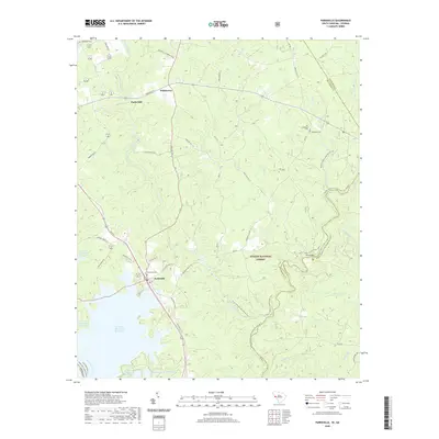
2020 Map of Parksville
USGS Topo · Published 2020About this map
Parksville stands as a central point of interest in this McCormick County landscape, where the waters of the Savannah River meet the extensive J Strom Thurmond Reservoir. The map reveals a transition from the structured street grid of the town to the dense woodlands of the Sumter National Forest. This area is defined by its deep hydrological network, with Stevens Creek, Turkey Creek, and numerous branches like Mack Br and Coon Cr carving through the terrain. Evidence of the region's agricultural and industrial past is preserved in place names such as Parks Mill and Whitetown. Genealogists will find significant value in the distribution of local burial sites, including Parksville Cem, Rehoboth Cem, and the Old Rehoboth Cem. Modern recreational use is highlighted by the Wine/Turkey Creek Hiking Trail and the Turkey/Stevens Creek Canoe Trail, indicating how the local economy and culture revolve around these historic waterways.
Find a feature on this map
51 named features on this map. Tap any name to fly to it.
Don’t see what you’re looking for? This feature index may not catch every label — zoom into the map to look around manually.
Map Details
Editions of this 2020 Parksville Map
This is the sole edition of this map. No revisions or reprints were ever made.
Other maps of this area

1892 · Mc Cormick
USGS Topo · 1:125,000

1912 · Mc Cormick
USGS Topo · 1:125,000

1920 · Clarks Hill
USGS Topo · 1:48,000

1921 · Clarks Hill
USGS Topo · 1:62,500

1921 · Appling
USGS Topo · 1:62,500

1941 · Clarks Hill
USGS Topo · 1:62,500

1942 · Clarks Hill
USGS Topo · 1:62,500

1943 · Appling
USGS Topo · 1:62,500

1953 · Athens
USGS Topo · 1:250,000

1958 · Athens
USGS Topo · 1:250,000