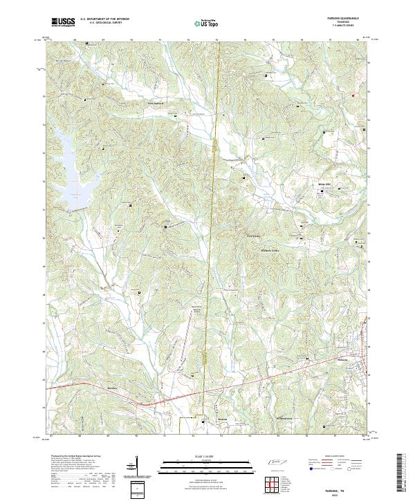
2022 Map of Parsons
USGS Topo · Published 2022About this map
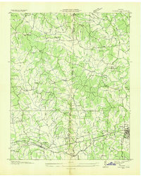
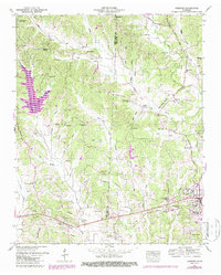
Parsons serves as the primary hub in this West Tennessee landscape, where the HENDERSON CO DECATUR CO line divides a region of creek-fed hollows and upland ridges. The terrain is defined by its numerous small-scale drainages, including Sulphur Fork Cub Cr and Big Cr, which historically dictated the placement of small agricultural communities and family plots. Local life is centered around rural junctions and landmarks like New Safford and Bible Hill, with the Beech River Regional Airport representing a modern addition to the interior.
Find a feature on this map
157 named features on this map. Tap any name to fly to it.
Don’t see what you’re looking for? This feature index may not catch every label — zoom into the map to look around manually.
Map Details
Editions of this 2022 Parsons Map
This is the sole edition of this map. No revisions or reprints were ever made.
Historical Maps of Five Forks Through Time
3 maps found