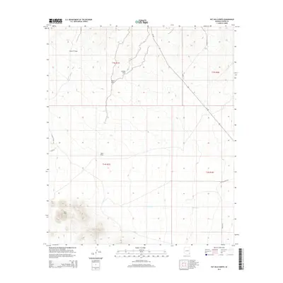
2014 Map of Pat Hills North
USGS Topo · Published 2014About this map
The Pat Hills rise in the southwestern corner of this desert landscape, where the high terrain gives way to a network of drainage channels in Cochise County. Water management and local cattle operations define the region's character, with named ephemeral drainages like Seven VT Draw, Cienega Draw, and Ideal Draw cutting through the arid flats. These features are vital landmarks in a territory where the Public Land Survey System grid lines divide large tracts of open range. The transit network is anchored by Az-186, which bisects the northeast, while a series of ranch-access routes including S Rancho Sacatal Rd and E Creasey Ranch Rd connect distant homesteads and operations to the main thoroughfare. In the southern half of the sheet, Pinery Cr tracks across the valley floor, illustrating the seasonal hydrography that has shaped the ranching history of this corner of Arizona.
Find a feature on this map
16 named features on this map. Tap any name to fly to it.
Don’t see what you’re looking for? This feature index may not catch every label — zoom into the map to look around manually.
Map Details
Editions of this 2014 Pat Hills North Map
This is the sole edition of this map. No revisions or reprints were ever made.
Other maps of this area

1916 · Pearce
USGS Topo · 1:125,000

1917 · San Simon
USGS Topo · 1:125,000

1917 · Chiricahua
USGS Topo · 1:125,000

1919 · Chiricahua
USGS Topo · 1:125,000

1922 · Willcox
USGS Topo · 1:125,000

1926 · Light
USGS Topo · 1:62,500

1926 · Cochise Head
USGS Topo · 1:62,500

1926 · Rucker
USGS Topo · 1:62,500

1943 · Dos Cabezas
USGS Topo · 1:62,500

1950 · Cochise Head
USGS Topo · 1:62,500