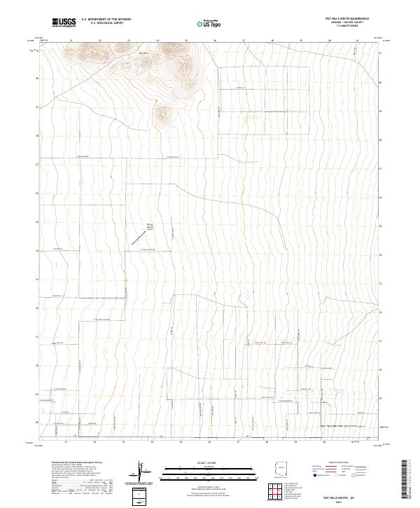
2021 Map of Pat Hills South
USGS Topo · Published 2021About this map
The Pat Hills rise in the northern portion of this Cochise County landscape, providing a topographic anchor to a region defined by modern rural development and vast desert stretches. This 2021 survey shows a structured grid of residential access roads and ranch lanes, such as S Chato Rd and Shepherd Hills Rd, carving into the arid terrain. The presence of the Rancho Relaxo Airport suggests the importance of private aviation in navigating this expansive southern Arizona environment.
Find a feature on this map
46 named features on this map. Tap any name to fly to it.
Don’t see what you’re looking for? This feature index may not catch every label — zoom into the map to look around manually.
Map Details
Editions of this 2021 Pat Hills South Map
This is the sole edition of this map. No revisions or reprints were ever made.
Other maps of this area

1916 · Pearce
USGS Topo · 1:125,000

1917 · San Simon
USGS Topo · 1:125,000

1917 · Chiricahua
USGS Topo · 1:125,000

1919 · Chiricahua
USGS Topo · 1:125,000

1922 · Willcox
USGS Topo · 1:125,000

1926 · Light
USGS Topo · 1:62,500

1926 · Cochise Head
USGS Topo · 1:62,500

1926 · Rucker
USGS Topo · 1:62,500

1943 · Dos Cabezas
USGS Topo · 1:62,500

1950 · Cochise Head
USGS Topo · 1:62,500