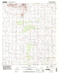
1996 Map of Pat Hills South
USGS Topo · Published 2002About this map
The Pat Hills dominate the northern landscape of this Cochise County region, where the terrain reveals a history of mineral exploration and ranching infrastructure. Arid drainage patterns are defined by the winding course of Turkey Creek and Fivemile Creek, which cut through a landscape dotted with numerous prospects and a specific Mine Shaft. These features suggest a period of active geological investigation and small-scale resource extraction typical of southeastern Arizona.
Find a feature on this map
9 named features on this map. Tap any name to fly to it.
Don’t see what you’re looking for? This feature index may not catch every label — zoom into the map to look around manually.
Map Details
Editions of this 1996 Pat Hills South Map
This is the sole edition of this map. No revisions or reprints were ever made.
Other maps of this area

1916 · Pearce
USGS Topo · 1:125,000

1917 · San Simon
USGS Topo · 1:125,000

1917 · Chiricahua
USGS Topo · 1:125,000

1919 · Chiricahua
USGS Topo · 1:125,000

1922 · Willcox
USGS Topo · 1:125,000

1926 · Light
USGS Topo · 1:62,500

1926 · Cochise Head
USGS Topo · 1:62,500

1926 · Rucker
USGS Topo · 1:62,500

1943 · Dos Cabezas
USGS Topo · 1:62,500

1950 · Cochise Head
USGS Topo · 1:62,500