Loading...
Loading map...2022 Map of Patrick Springs
USGS Topo · Published 2022About this map
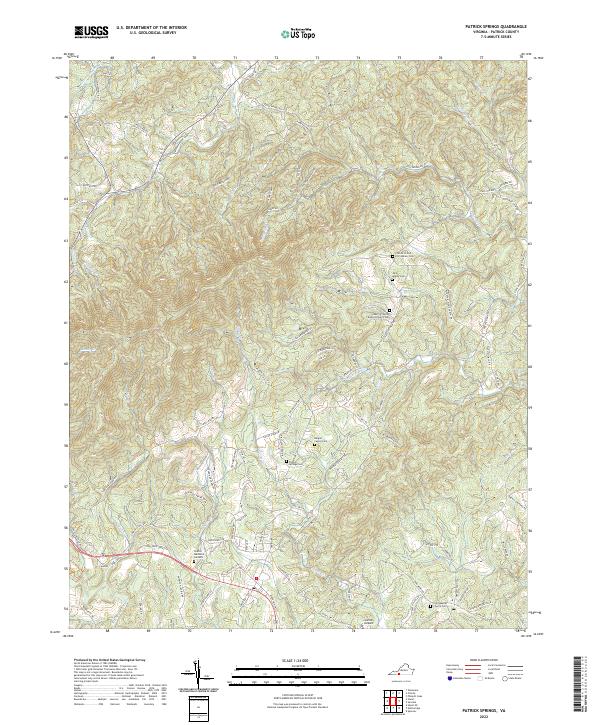
South Mayo River winds through the southern reaches of this Patrick County landscape, anchoring a terrain defined by many small waterways and family-named landmarks. The area's genealogical depth is evident in the numerous burial sites and houses of worship that dot the countryside, including the Burgart Family Cem and the John Adams Cem. Settlement patterns follow the high ridges and winding creek beds, with rural routes like Pole Bridge Rd and State Rte 687 connecting the community.
Find a feature on this map
97 named features on this map. Tap any name to fly to it.
Don’t see what you’re looking for? This feature index may not catch every label — zoom into the map to look around manually.
Map Details
Date Portrayed2022
Date Published2022
PublisherU.S. Geological Survey
Map TypeTopographic
Scale1:24000
Physical Dimensions24 x 29 inches
Editions of this 2022 Patrick Springs Map
This is the sole edition of this map. No revisions or reprints were ever made.
Historical Maps of Patrick Springs Through Time
Featured Locations
Source Details
SourceU.S. Geological Survey
CopyrightPublic Domain