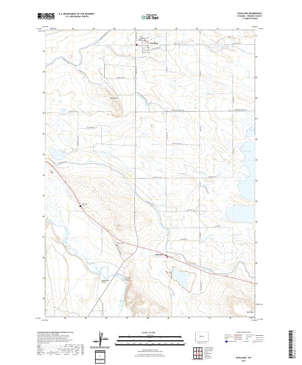
2021 Map of Pavillion
USGS Topo · Published 2021About this map
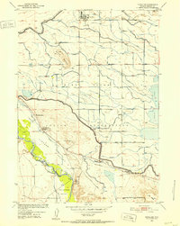
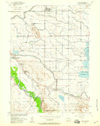
Pavillion and Kinnear anchor this landscape of the Wind River Basin, where a complex network of irrigation infrastructure transformed the high plains into productive agricultural land. The map illustrates the sophisticated water management system supporting Kinnear Valley and Johnstown Valley, featuring the Pilot Canal, Sand Butte Lateral, and Aragon Ditch. These waterways, alongside the Sunnyside Drain and Pilot Drain, define the settlement patterns and road grids of the region.
Find a feature on this map
48 named features on this map. Tap any name to fly to it.
Don’t see what you’re looking for? This feature index may not catch every label — zoom into the map to look around manually.
Map Details
Editions of this 2021 Pavillion Map
This is the sole edition of this map. No revisions or reprints were ever made.
Historical Maps of Kinnear Through Time
3 maps found