Loading...
Loading map...2024 Map of Pawnee
USGS Topo · Published 2024About this map
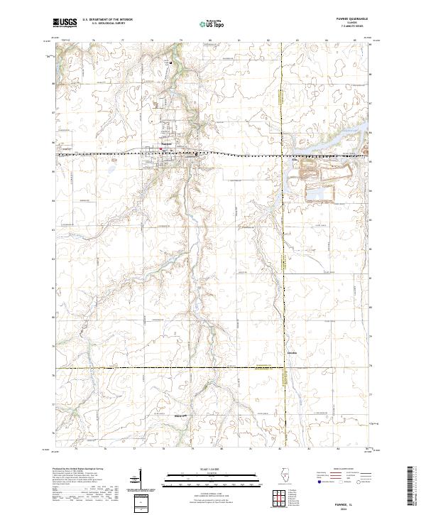
Pawnee serves as the primary hub of this central Illinois landscape, situated at a junction of regional routes including Co RD 1650 N and S Pawnee Rd. The town’s history is reflected in its local landmarks, such as Calvary Cem and the nearby Horse Creek Cem. The terrain is defined by a dendritic drainage pattern where Horse Creek and its tributaries, including West Branch Horse Creek and Henkle Branch, carve through the agricultural fields of the Prairie State.
Find a feature on this map
76 named features on this map. Tap any name to fly to it.
Don’t see what you’re looking for? This feature index may not catch every label — zoom into the map to look around manually.
Map Details
Date Portrayed2024
Date Published2024
PublisherU.S. Geological Survey
Map TypeTopographic
Scale1:24000
Physical Dimensions24 x 29 inches
Editions of this 2024 Pawnee Map
This is the sole edition of this map. No revisions or reprints were ever made.
Historical Maps of Pawnee Through Time
Featured Locations
Source Details
SourceU.S. Geological Survey
CopyrightPublic Domain