2023 Map of Payne
USGS Topo · Published 2023About this map
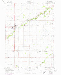
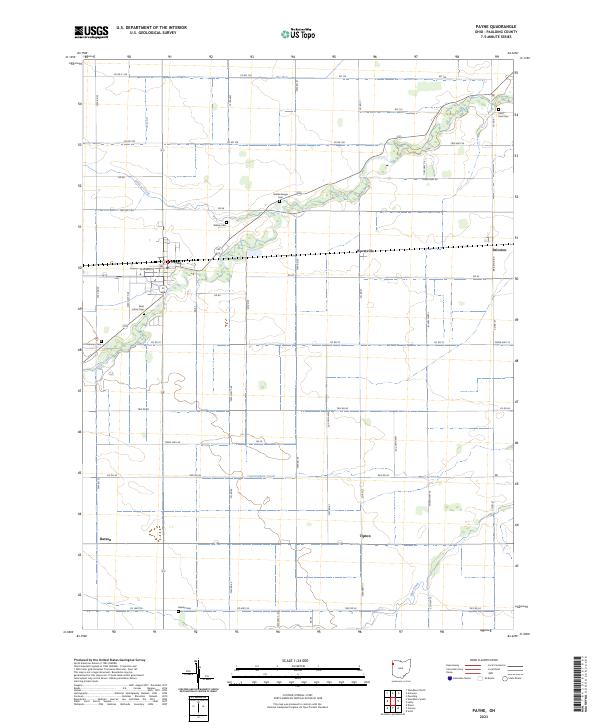
Payne sits at the intersection of local routes and drainage networks in this rural section of Paulding County. The village is characterized by a grid-like street plan, including W Merrin St, and serves as the primary hub for the surrounding agricultural townships. The landscape is defined by the gentle meandering of Flatrock Creek and its tributaries, such as Wildcat Creek and Cunningham Creek, which dictate the placement of early road corridors like Briceton Rd. For those researching local history, several family and denominational burial grounds are scattered across the landscape, including Saint Johns Cem, Wiltsie Cem, and Dealey Cem. Smaller settlements like Worstville, Briceton, and Tipton mark the map as former rail or road junctions that once anchored these farming communities.
Find a feature on this map
65 named features on this map. Tap any name to fly to it.
Don’t see what you’re looking for? This feature index may not catch every label — zoom into the map to look around manually.
Map Details
Editions of this 2023 Payne Map
This is the sole edition of this map. No revisions or reprints were ever made.