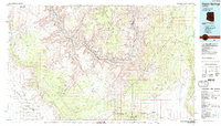
1986 Map of Peach Springs
USGS Topo · Published 1987About this map
Hualapai Indian Reservation lands dominate this mid-1980s landscape, where the Colorado River carves through the dramatic depths of the Granite Gorge. The map captures a transitional geography between the high Shivwits Plateau and the Hualapai Valley, documenting the critical water sources that sustain this arid region, such as Peach Springs and Milkweed Spring.
Find a feature on this map
93 named features on this map. Tap any name to fly to it.
Don’t see what you’re looking for? This feature index may not catch every label — zoom into the map to look around manually.
Map Details
Editions of this 1986 Peach Springs Map
2 editions found
Other maps of this area

1886 · Diamond Creek
USGS Topo · 1:250,000

1886 · Camp Mohave
USGS Topo · 1:250,000

1886 · Saint Thomas
USGS Topo · 1:250,000

1886 · Mt. Trumbull
USGS Topo · 1:250,000

1886 · Chino
USGS Topo · 1:250,000

1886 · Kaibab
USGS Topo · 1:250,000

1891 · Chino
USGS Topo · 1:250,000

1892 · Diamond Creek
USGS Topo · 1:250,000

1892 · Mt. Trumbull
USGS Topo · 1:250,000

1892 · Camp Mohave
USGS Topo · 1:250,000