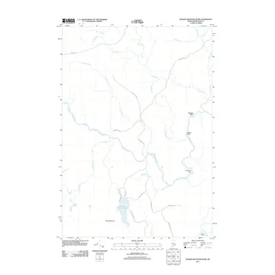
2011 Map of Peaked Mountain Pond
USGS Topo · Published 2011About this map
Peaked Mountain Pond and the surrounding woodlands of Washington County define this landscape as it appeared in the early 21st century. The Machias River winds through the central portion of the quadrangle, joined by numerous tributaries including Soddy Meadow Brook, Libby Brook, and Palmer Brook. Human presence is marked by a network of rural routes such as Holmes Falls Rd and Jacks Camp Rd, leading to remote landmarks like the Mattimo Place and the settlement at Rivers End. To the south, the terrain rises toward Peaked Mountain, which overlooks the smaller Grassy Pond. The map detail captures the characteristic river bends of the region, most notably at The Oxbow on the Chandler River. This survey serves as a precise record of the interior Maine wilderness, documenting the specific points where logging roads and watercourses intersect.
Find a feature on this map
29 named features on this map. Tap any name to fly to it.
Don’t see what you’re looking for? This feature index may not catch every label — zoom into the map to look around manually.
Map Details
Editions of this 2011 Peaked Mountain Pond Map
This is the sole edition of this map. No revisions or reprints were ever made.
Other maps of this area

1902 · Cherryfield
USGS Topo · 1:62,500

1904 · Cherryfield
USGS Topo · 1:62,500

1921 · Columbia Falls
USGS Topo · 1:62,500

1921 · Columbia Falls
USGS Topo · 1:62,500

1941 · Columbia Falls
USGS Topo · 1:62,500

1941 · Wesley
USGS Topo · 1:62,500

1941 · Tug Mountain
USGS Topo · 1:62,500

1942 · Cherryfield
USGS Topo · 1:62,500

1942 · Columbia Falls
USGS Topo · 1:62,500

1943 · Tug Mountain
USGS Topo · 1:62,500