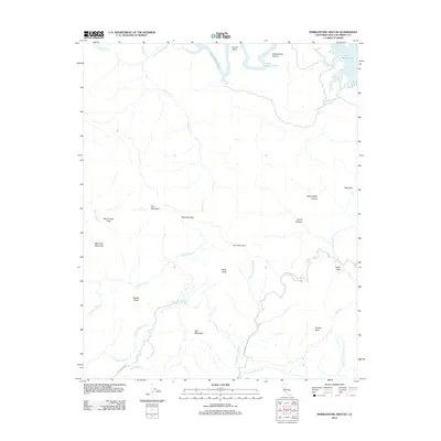
2012 Map of Pebblestone Shut-in
USGS Topo · Published 2012About this map
Lake Nacimiento dominates the northern reaches of this landscape, its winding shoreline and arms like Grizzly Bend and Pebblestone Shut-in defining the drainage of the Santa Lucia Range. The terrain is characterized by high ridges and distinct peaks, including Black Oak Mountain, Pine Mountain, and Red Mountain. Civil infrastructure is sparse, represented primarily by access routes like Keystone Mine Rd and Town Creek Truck Trl, which navigate the steep topography. From the vantage of Rocky Butte Lookout, one can survey a network of canyons and flats, such as McLaughlin Canyon and Almaden Flats. This map captures the area before modern development, showing a land primarily defined by its hydrology, with numerous seasonal streams like Tobacco Creek and the N Fork Pico Cr flowing from the high ridges toward the coast and the reservoir.
Find a feature on this map
32 named features on this map. Tap any name to fly to it.
Don’t see what you’re looking for? This feature index may not catch every label — zoom into the map to look around manually.
Map Details
Editions of this 2012 Pebblestone Shut-in Map
This is the sole edition of this map. No revisions or reprints were ever made.
Other maps of this area

1919 · Bryson
USGS Topo · 1:62,500

1919 · Bradley
USGS Topo · 1:62,500

1919 · Adelaida
USGS Topo · 1:62,500

1919 · San Simeon
USGS Topo · 1:62,500

1932 · Adelaida
USGS Topo · 1:62,500

1937 · San Simeon
USGS Topo · 1:62,500

1941 · Bradley
USGS Topo · 1:62,500

1941 · Bryson
USGS Topo · 1:62,500

1942 · Adelaida
USGS Topo · 1:62,500

1942 · Bryson
USGS Topo · 1:62,500