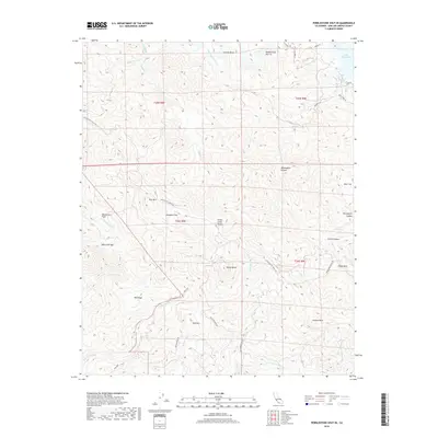
2018 Map of Pebblestone Shut-in
USGS Topo · Published 2018About this map
Pebblestone Shut-In serves as the focal point for this section of the Santa Lucia Range, where the Nacimiento River winds through high relief toward Lake Nacimiento. The landscape is defined by its series of distinct peaks and ridges, including Rocky Butte, Black Oak Mtn, and Red Mtn. Historically, the area's resource-driven past is suggested by Keystone Mine Rd and Red Mountain Rd, providing access to these elevated interior lands.
Find a feature on this map
43 named features on this map. Tap any name to fly to it.
Don’t see what you’re looking for? This feature index may not catch every label — zoom into the map to look around manually.
Map Details
Editions of this 2018 Pebblestone Shut-in Map
This is the sole edition of this map. No revisions or reprints were ever made.
Other maps of this area

1919 · Bryson
USGS Topo · 1:62,500

1919 · Bradley
USGS Topo · 1:62,500

1919 · Adelaida
USGS Topo · 1:62,500

1919 · San Simeon
USGS Topo · 1:62,500

1932 · Adelaida
USGS Topo · 1:62,500

1937 · San Simeon
USGS Topo · 1:62,500

1941 · Bradley
USGS Topo · 1:62,500

1941 · Bryson
USGS Topo · 1:62,500

1942 · Adelaida
USGS Topo · 1:62,500

1942 · Bryson
USGS Topo · 1:62,500