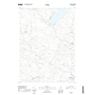
2019 Map of Peck Lake
USGS Topo · Published 2019About this map
Peck Lake and its surrounding uplands dominate this landscape in Fulton County, where numerous small settlements and water resources define the local geography. The northern edge of Johnstown appears at the bottom of the map, serving as the regional hub near the Fulton County Office Building. The terrain is marked by several prominent heights such as Clapper Hill and Erkenbrack Hill, which overlook a network of rural hamlets including North Bush, West Bush, and Meco. Genealogists will find several burial grounds mapped in detail, including Rhodes Cem, McBeth Cem, and Kecks Center Cem near the intersection of local routes. The area’s water management is evident through the Cold Brook Reservoir and Canajoharie Reservoir, which sit alongside natural features like Mud Lake and Sprite Cr. This map documents a stable rural landscape where modern roads like Co Hwy 137 follow historical settlement patterns.
Find a feature on this map
84 named features on this map. Tap any name to fly to it.
Don’t see what you’re looking for? This feature index may not catch every label — zoom into the map to look around manually.
Map Details
Editions of this 2019 Peck Lake Map
This is the sole edition of this map. No revisions or reprints were ever made.
Other maps of this area

1896 · Fonda
USGS Topo · 1:62,500

1898 · Fonda
USGS Topo · 1:62,500

1898 · Canajoharie
USGS Topo · 1:62,500

1900 · Canajoharie
USGS Topo · 1:62,500

1901 · Lassellsville
USGS Topo · 1:62,500

1902 · Canajoharie
USGS Topo · 1:62,500

1902 · Fonda
USGS Topo · 1:62,500

1903 · Gloversville
USGS Topo · 1:62,500

1903 · Lassellsville
USGS Topo · 1:62,500

1943 · Gloversville
USGS Topo · 1:62,500