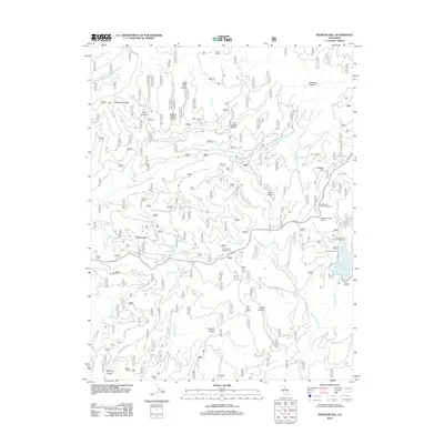
2012 Map of Peddler Hill
USGS Topo · Published 2012About this map
Peddler Hill rises above the high-elevation terrain of El Dorado County, defining a landscape shaped by deep canyons and seasonal alpine recreation. By the early 21st century, this area had become a key recreational corridor, anchored by the Lower Bear River Reservoir and the Bear River Resort Ski Area. The map reveals a complex network of forest roads and ridges, including Telephone Ridge and Cat Creek Ridge, which separate the various drainages of the Middle Fork Cosumnes River and its tributaries like Prothro Cr and Shingle Mill Cr. Small, specialized landmarks like Loggers Delight Canyon and Grelich Camp suggest the long history of timber management in the Sierra Nevada, while locations such as Peddler Hill Scenic Viewpoint and Lumberyard Campground highlight the area's transition into a destination for modern campers and outdoor enthusiasts.
Find a feature on this map
39 named features on this map. Tap any name to fly to it.
Don’t see what you’re looking for? This feature index may not catch every label — zoom into the map to look around manually.
Map Details
Editions of this 2012 Peddler Hill Map
This is the sole edition of this map. No revisions or reprints were ever made.
Other maps of this area

1889 · Pyramid Peak
USGS Topo · 1:125,000

1891 · Big Trees
USGS Topo · 1:125,000

1891 · Pyramid Peak
USGS Topo · 1:125,000

1894 · Big Trees
USGS Topo · 1:125,000

1895 · Pyramid Peak
USGS Topo · 1:125,000

1896 · Pyramid Peak
USGS Topo · 1:125,000

1897 · Big Trees
USGS Topo · 1:125,000

1901 · Big Trees
USGS Topo · 1:125,000

1947 · Sacramento
USGS Topo · 1:250,000

1948 · Sacramento
USGS Topo · 1:250,000