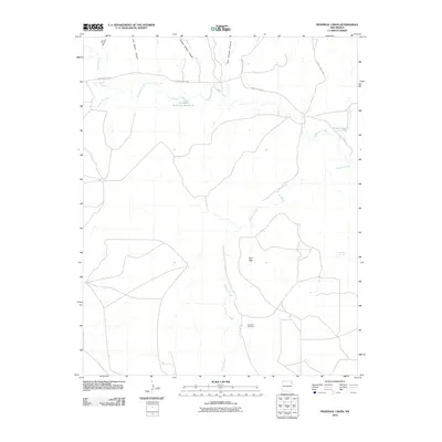
2010 Map of Pedernal Creek
USGS Topo · Published 2010About this map
Pedernal Cemetery serves as a silent landmark in this rural landscape of Union County, reflecting the deep ties to the land in this northeastern corner of New Mexico. The geography is defined by a network of drainage systems, including the namesake Pedernal Creek and the meandering Tramperos Creek, which are fed by rugged draws such as San Lorenzo Canyon and Charley Adams Canyon. This 2010 survey illustrates the ranching infrastructure of the region, featuring water management sites like Smithson Reservoir Number 2 and Franks Dam. The elevation rises toward the Flint Hills, while historic springs like Morrison Spring point toward the essential water sources that once supported local homesteaders and cattle operations in this arid high plains environment.
Find a feature on this map
15 named features on this map. Tap any name to fly to it.
Don’t see what you’re looking for? This feature index may not catch every label — zoom into the map to look around manually.
Map Details
Editions of this 2010 Pedernal Creek Map
This is the sole edition of this map. No revisions or reprints were ever made.
Other maps of this area

1954 · Tucumcari
USGS Topo · 1:250,000

1954 · Dalhart
USGS Topo · 1:250,000

1958 · Tucumcari
USGS Topo · 1:250,000

1958 · Dalhart
USGS Topo · 1:250,000

1962 · Dalhart
USGS Topo · 1:250,000

1966 · Skull Mesa
USGS Topo · 1:24,000

1966 · Pedernal Creek
USGS Topo · 1:24,000

1966 · Clapham
USGS Topo · 1:24,000

1966 · Car Top Butte
USGS Topo · 1:24,000

1966 · Hayden
USGS Topo · 1:24,000