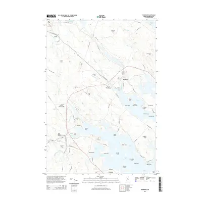
2014 Map of Pembroke
USGS Topo · Published 2014About this map
Pembroke and West Pembroke sit at the head of the Pennamaquan River estuary, anchoring a landscape where the tidal waters of Dennys Bay meet the forested hills of Washington County. This survey captures the region's intricate coastal geography, defined by numerous points and necks such as Leighton Neck and Hersey Neck that reach into the salt water. Inland, the terrain rises toward heights like Ironworks Mtn and Mt Tom, while the Dennys River flows past the village of Dennysville. The layout of the land reflects a deep connection to the water, with roads like Brickyard Rd and Old Mill Rd hinting at the maritime and early industrial history of the settlements. Farther north, the transition to freshwater environments is marked by Boyden Lake and the Pennamaquan River Reservoir, while the remote rail junction at Ayers remains a point of interest for those tracing the path of the old Washington County Railroad.
Find a feature on this map
106 named features on this map. Tap any name to fly to it.
Don’t see what you’re looking for? This feature index may not catch every label — zoom into the map to look around manually.
Map Details
Editions of this 2014 Pembroke Map
This is the sole edition of this map. No revisions or reprints were ever made.
Other maps of this area

1907 · Eastport
USGS Topo · 1:48,000

1908 · Eastport
USGS Topo · 1:62,500

1929 · Calais
USGS Topo · 1:48,000

1929 · Robbinston
USGS Topo · 1:48,000

1931 · Robbinston
USGS Topo · 1:62,500

1932 · Calais
USGS Topo · 1:62,500

1941 · Gardner Lake
USGS Topo · 1:62,500

1943 · Gardner Lake
USGS Topo · 1:62,500

1943 · Eastport
USGS Topo · 1:62,500

1945 · Eastport
USGS Topo · 1:62,500