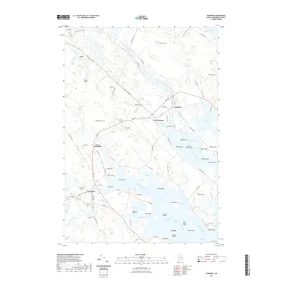
2021 Map of Pembroke
USGS Topo · Published 2021About this map
Pembroke and West Pembroke sit at the head of the Pennamaquan River, a tidal waterway that defines the character of this Washington County landscape. The map illustrates a complex coastal environment where the Dennys River and Orange River meet the sea at Dennys Bay, creating a network of coves and points including Sipp Bay, Hersey Cove, and Ox Cove. Inland, the terrain is shaped by low peaks such as Ironworks Mtn, Porcupine Mtn, and Big Hill, while the settlement of Ayers marks a junction in the northwestern corner. Local heritage is preserved in sites like Forest Hill Cem and the Dennysville Cem, while the natural topography features distinct landmarks like Cobscook Falls and the rocky Leighton Ledges. This documentation shows how modern roads like Ayers Junction Rd and River Rd follow the historical contours of the river valleys and coastal necks.
Find a feature on this map
107 named features on this map. Tap any name to fly to it.
Don’t see what you’re looking for? This feature index may not catch every label — zoom into the map to look around manually.
Map Details
Editions of this 2021 Pembroke Map
This is the sole edition of this map. No revisions or reprints were ever made.
Other maps of this area

1907 · Eastport
USGS Topo · 1:48,000

1908 · Eastport
USGS Topo · 1:62,500

1929 · Calais
USGS Topo · 1:48,000

1929 · Robbinston
USGS Topo · 1:48,000

1931 · Robbinston
USGS Topo · 1:62,500

1932 · Calais
USGS Topo · 1:62,500

1941 · Gardner Lake
USGS Topo · 1:62,500

1943 · Gardner Lake
USGS Topo · 1:62,500

1943 · Eastport
USGS Topo · 1:62,500

1945 · Eastport
USGS Topo · 1:62,500