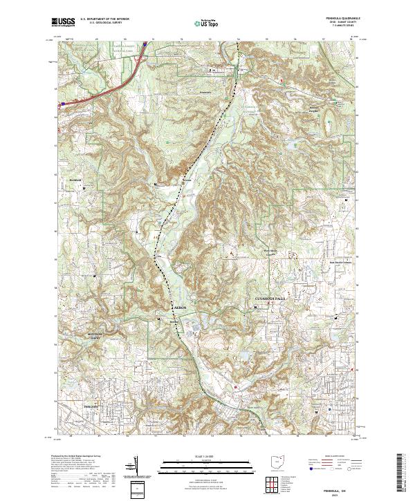
2023 Map of Peninsula
USGS Topo · Published 2023About this map
The Cuyahoga River carves a deep valley through this portion of Summit County, anchoring a landscape where small settlements like Peninsula and Everett are preserved within the Cuyahoga Valley National Park. The topography is defined by significant outcrops and ridges, including the Boston Ledges and Ritchie Ledges, which contrast with the wetlands of Tamarack Swamp and Kool Lake. This survey illustrates the proximity of these protected natural spaces to the urban expansion of Akron and Cuyahoga Falls to the south.
Find a feature on this map
70 named features on this map. Tap any name to fly to it.
Don’t see what you’re looking for? This feature index may not catch every label — zoom into the map to look around manually.
Map Details
Editions of this 2023 Peninsula Map
This is the sole edition of this map. No revisions or reprints were ever made.
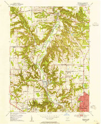
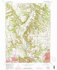
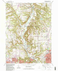
Historical Maps of Peninsula Through Time
4 maps found